| |
Galveston
and Texas History Center |
| GTHC Home Pre-1900 Storm 1900 Storm Special Collections 1909 Storm 1915 Storm 1919 Storm Causeway Grade Raising Seawall | |

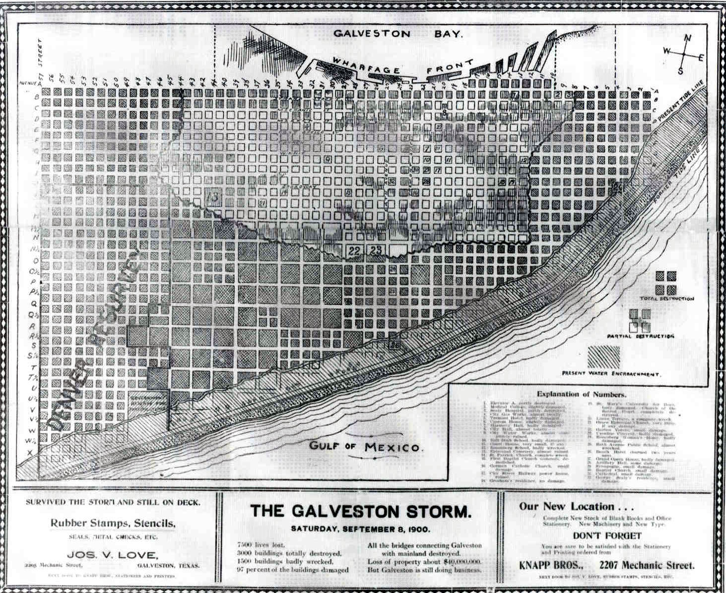
MAP OF THE 1900 STORM DAMAGE
Map #456B The Galveston Storm. Saturday, September 8, 1900. Anonymous. Galveston, 1900. Scale indeterminable. 36.5 x 44 cm.
This map graphically
shows the levels of damage Galveston sustained as a result of the hurricane.
The beachfront (the shaded portion of the city closest to the Gulf of Mexico)
was completely lost. A swath of complete destruction, roughly bounded by 8th
Street (east), 46th Street (west), and Avenue O (north), was the next level.
Few buildings survived there. A zone of partial destruction, including the waterfront
and the downtown area, occupied the innermost portion of Galveston.
Galveston and Texas History Center I Rosenberg Library
Funding for the
1900 Storm Photo Exhibit was provided by a grant from the Institute of Museum
and Library Services and the Texas State Library and Archives Commission.
If you are interested in a copy of this image, please review our
photo reproduction policy and contact us by e-mail.
Galveston and Texas
History Center, Rosenberg Library, 2310 Sealy Avenue, Galveston TX 77550
Voice (409) 763-8854 ext. 127- Fax (409) 763-0275
GTHC
WebTeam GTHC, Rosenberg Library.